AMAD
"Archivum Medii Aevi Digitale - Specialized open access repository for research in the middle ages"To submission
Full metadata record
| DC Field | Value | Language |
|---|---|---|
| Author | Monteleone, Cosimo | - |
| Date | 2016 | - |
| Other Identifier | http://www.serena.unina.it/index.php/eikonocity/article/download/3746/4147 | - |
| Other Identifier | https://doi.org/10.6092/2499-1422/3746 | - |
| Other Identifier | http://www.serena.unina.it/index.php/eikonocity/article/view/3746 | - |
| URI | https://www.amad.org/jspui/handle/123456789/82148 | - |
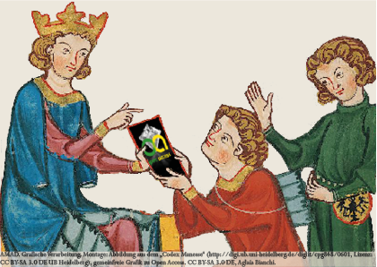
| Description | Nel corso del Rinascimento l’evolversi della perspectiva artificialis e delle tecniche di rilevamento urbano, solitamente eseguito ricorrendo a specifici strumenti per la delineazione prospettica – come quello creato dal Lanci –, costituirono un fattore determinante per una nuova idea di spazio. Ma la consapevolezza che la realtà fosse misurabile già si faceva lentamente strada per mezzo degli studi intensivi di Ottica medievale e della riscoperta di alcuni antichi testi scientifici come la Geografia di Tolomeo. Infatti, mentre la perspectiva naturalis certificava l’importanza cruciale della distanza tra osservatore e piano iconico, le reminiscenze classiche introducevano l’espediente della griglia geometrica per fissare univocamente la posizione di un punto sulla superficie terrestre. Al sottile legame tra i ‘ritratti di città’ e il mondo scientifico della Rappresentazione fece inequivocabilmente cenno Giorgio Vasari, che nei suoi Ragionamenti ricordò di aver costruito la celebre veduta intitolata L’Assedio di Firenze per palazzo Vecchio, utilizzando, tra gli altri strumenti di misura, anche le ‘occhiate al naturale’. ; During the Renaissance the rigorous perspective associated with the urban ‘surveys’, performed through ad hoc perspective instruments – as the tool created by Lanci – was an essential factor for the success of a new idea of space. The awareness of measuring the reality comes after extensive studies of medieval Optics and the rediscovery of Ptolemy’s Geography. The first explains the importance of the distance between the observer and the iconic plane, while the second introduces the concept of the geometric grid to locate a point on the Earth’s surface. Finally the link between these new ‘city-views’ with the world of Representation is unequivocally demonstrated by Vasari, who in his Ragionamenti remembers to have obtained the famous view titled Assedio di Firenze for Palazzo Vecchio, using also, among other measuring tools, the ‘occhiate al naturale’. | - |
| Format | application/pdf | - |
| Language | ita | - |
| Rights | Copyright (c) 2016 Cosimo Monteleone | - |
| Keywords | rilievo. | - |
| Keywords | ICAR/17 | - |
| Keywords | Ottica | - |
| Keywords | Lanci | - |
| Keywords | prospettografo | - |
| Keywords | viste urbane | - |
| Keywords | survey. | - |
| Keywords | urban view | - |
| Keywords | perspective devices | - |
| Keywords | Optics | - |
| Keywords | Representation of Architecture and Landscape | - |
| Dewey Decimal Classification | 940 | - |
| Title | Quæstiones perspectivæ. Osservazioni sulla rappresentazione della città nel Rinascimento ; Quæstiones perspectivæ: the representation of the city in the Renaissance | - |
| Type | info:eu-repo/semantics/article | - |
| Type | info:eu-repo/semantics/publishedVersion | - |
| AMAD ID | 696039 | - |
| Year | 2016 | - |
| Open Access | 1 | - |
| Appears in Collections: | BASE (Bielefeld Academic Search Engine) General history of Europe | |
Files in This Item:
There are no files associated with this item.
Items in DSpace are protected by copyright, with all rights reserved, unless otherwise indicated.